Menu


Menu |
|
 |
File open (CTRL-O)
Selection of a file in the supported format by using the file open dialog. The selected image will then be shown in the Image-View. The filename is stored in the files-table together with the creation date of the image. If the meta data of the image contain gps-data the coordinates will be entered into the coordinates table.
|
|
Import GPS-Data(CTRL-D)
Opens the file open dialog to select GPS-Data in the supported format (*.log and *.gpx). After reading the file, the coordinates are stored in the coordinates table.
|
|
Read user defined locations (CTRL-R)
Selection of the definitions file in the supported format (*.pod). After reading the file, all locations are shown in the Orte in der Location-View.
|
|
Import image folder (CTRL-I)
Selection of the folder with images which are to be synchronized with coordinates. After reading the folder the images are shown in the images tab as thumbnails and list of pathes. Please note, that it is possible to import single files as well by using Drag & Drop.
|
|
Save Locations (CTRL-S)
Saves the user defined locations in the selected definitions file which has been read before. If no definitios file was read befor you must specify a file name, see Function Location save as... aufgerufen.
|
|
Locations save as...
With this function you can choose the destination file for user defined locations.
|
|
Exit pixafe earth (CTRL-X)
Exits pixafe earth
|
|
Delete image
Deletes the current image
|
|
Empty coordinates list
Empties the list of coordinates.
|
|
Empty image list
Empties the list of images
|
|
Define location...
opens the dialog to define and edit user defined locations. If the currently a coordinate is marked, this coordinate will be taken as center of the new location, otherwise you can define all properties of the new location including the center.
|
|
Rename location...
Opens the dialog to rename locations.
|
|
Edit location...
opens the dialog to define and edit user defined locations. You can change the coordinates and the ambit. The change of the name is not possible because this is the identification of each location. If you need to rename a location, use the function rename location.
|
|
Delete location
Deletes the currently marked location.
|
|
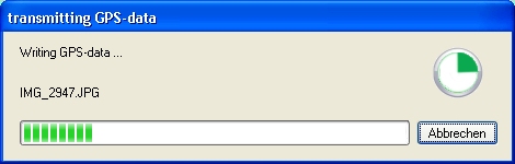
Write EXIF- and IPTC data...
Starts a batch job which writes all the coordinates and location names directly into the
metadata of the images. For this the original images are copied into a new folder which
the user can select.
|
|
Detect location names
Starts a batch job, which gets the names of the mapped images with coordinates. The names are detected to the coordinates of the images. This function is normally called automatically in the background but if the job comes to a time out the user can call it later again.
|
|
Synchronize images and coordinates
This function is normally called automatically. It is used to map the coordinates to the images. After this function has completed, the mapped coordinates and images are shown green and those which could not be mapped are shown red.
|
|
Adjust camera time
The mapping of images to coordinates is done by the creation time stamp of the coordinate and the image. If the clock of the camera is not synchron to the world-clock, than you can adjust this time by using the special dialog.
|
|
Coordinates with images only
shows in the list of coordinates only those which could be mapped to images.
|
|
Images with coordinates only
shows in the list of images only those images which could be mapped to coordinates.
|
|
Image to location...
Reduces the shown images to those which are taken at a special location. This location is entered in a special dialog.
|
|
Images to date...
Reduces the shown images to those which are taken at a special date. You can select the date by using the special dialog. In order to show all images, remove the check in the menu.
|
|
Show track...
Shows the track in a special dialog.
|
|
Coordinates
You can specify if you would like to show the first, next, prev or last coordinate. After selection the selected coordinate is shown in the map
|
|
Images
You can specify if you would like to show the first, next, prev or last image. After selection the selected image is shown in the tab Bild wird sodann in der Ansicht image.
|
|
Goto location
You can specifiy an user defined location in order to show it in the map.
|
|
About pixafe Earth
Shows the about box with version number and links to the pixafe website
|
|
Content
Shows the online help
|
|
Search
Shows the online help with the possibility to search to keywords.
|
All input files and folders can be entered by drag and drop: Images, Image folders, GPS files and user defined locations.
|